
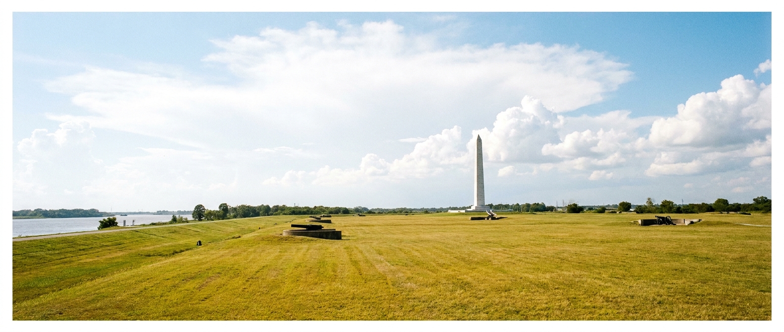
The first time I walked Chalmette Battlefield, the Mississippi River air had that familiar damp bite and the wind moved through the grass like it was still trying to carry orders down the line. This place can look quiet, even ordinary, on a modern afternoon. But if you know where to stand, what to face, and what to picture, the Battle of New Orleans snaps into focus with a kind of clarity that makes you lower your voice without meaning to.
This guide is built for modern visitors: where to start, how to walk it, what details people routinely miss, and how to connect the monuments and plaques to the gritty, human story that unfolded here in January 1815.
Know the story first
The Battle of New Orleans (January 8, 1815) came at a strange moment. The Treaty of Ghent was signed on December 24, 1814, in Ghent, but news traveled slowly across the Atlantic. Armies marched and men died without knowing peace was already on paper.
Here outside New Orleans, a British force pressed toward the city. Andrew Jackson’s army was an improvised quilt. It included U.S. regulars, state militia, New Orleans units of free men of color, sailors and Marines, and Native allies, including Choctaw. The American defensive line, anchored behind the Rodriguez Canal ditch and earthworks, became the decisive factor. The fighting on January 8 was brutally lopsided once the British assault bogged down in the open. That imbalance is part of why the battlefield can feel haunting even now. You can still sense how exposed the attackers were, and how protected the defenders were, just by standing in the right spot and looking across the flat ground.
If you want quick orientation to where this fight sits in the larger war, I keep my own bigger-picture pages handy at Battles and Timeline.
Start at the visitor center
I have learned a hard rule from years of battlefield wandering: start where the site staff want you to start. Not because you need permission to be moved by history, but because battlefields are puzzles. The visitor center is your legend and key.
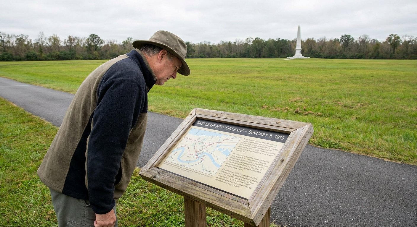
- Get your bearings. Look at maps first, then step outside and match the map to what your eyes see.
- Ask what is open. Trails and building access can change due to weather, repairs, or staffing.
- Ask one good question. My favorite: “Where is the spot visitors stand that gives them the wrong impression?” Rangers and volunteers love this because it lets them correct myths immediately.
You can usually handle the basics here too: parking, restrooms, water fountains, and the simplest route for your time and mobility level. If those services are limited on the day you arrive, staff will tell you fast.
For official hours, directions, alerts, and any current fee information, the National Park Service page is the most reliable place to check right before you drive out: https://www.nps.gov/jela/index.htm.
A simple walking route
If you only have an hour or two, you can still leave with a solid mental picture. This is the route I recommend for first-timers.
1) Find the line first
Before monuments, before portraits, before hero stories, find the basic geometry of the fight. The American line was built to deny the British a clean approach to the city. At Chalmette, the landscape is flat enough that small changes in elevation and manmade earthworks mattered enormously.
Stand where the interpretive materials point you to the American position, then look outward across the field. Do not rush this. Imagine doing it in wet wool, with a musket that needs dry powder, and a morning fog that makes every shadow feel like a threat.
2) Walk into the open ground
Now reverse the perspective. Walk out into the field far enough that you can look back toward the defensive line. This is the moment most visitors remember. The distance looks manageable until you picture crossing it under fire. It is not just distance. It is exposure, footing, and time.
3) End with the markers
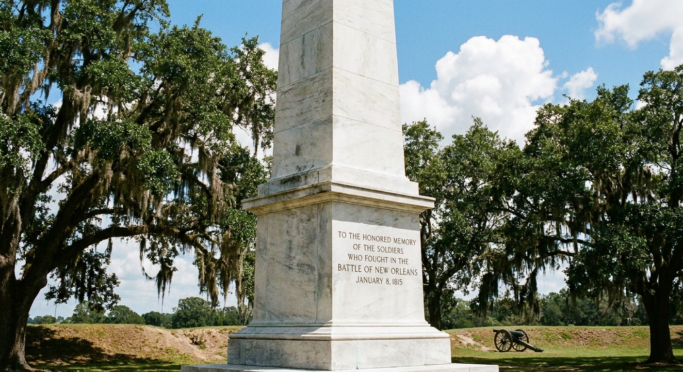
After your eyes understand the terrain, then let the names and units settle onto it. Monuments can feel abstract when you have not read the land yet. Once you have, they become anchors for real positions and real decisions.
Details people miss
Chalmette is not a place that overwhelms you with preserved fort walls or towering ruins. Its power is subtler. Here are the things I tell friends to slow down for.
The battlefield is bigger than the fence
The modern park protects key ground, but battle landscapes spill beyond neat boundaries. Roads, levees, and later development changed the edges. When you read markers, pay attention to what they imply about the surrounding area. You are often being shown a surviving piece of a much larger chessboard.
Listen for the river
The Mississippi is not background scenery here. It is a highway, a supply line, a barrier, and a compass point. When a breeze carries the river sound or the smell of wet silt, take it seriously as part of the setting. Armies in 1815 oriented their whole world around that moving water.
Look for bad footing clues
Even on a pleasant day, you can often spot how the ground holds moisture or how certain patches stay softer. In 1815, mud and canal edges were not inconveniences. They were tactical obstacles that could break an attack’s timing and cohesion.
Read small markers slowly
Big monuments tell you who won and who is honored. Small plaques often tell you what it felt like. When a marker mentions a regiment’s approach, a battery’s placement, or the ditch and parapet, pause and physically point the direction it describes. Your body becomes the map. That trick makes the story stick.
What survives and what does not
Visitors often ask for “original buildings.” Chalmette is tricky on that front because the battlefield is a working landscape that has been reshaped by time, storms, and the practical needs of a living region.
What does survive most reliably is the relationship between river, open ground, and defensive position. That is the authentic spine of the site. If you come expecting a row of untouched 1815 structures, you might leave disappointed. If you come expecting to understand why men could not advance, where they bunched up, and how a defensive line turns open land into a killing zone, you will leave with something far more valuable than bricks.
My advice is to treat any surviving or reconstructed elements as teaching tools, not as museum relics. The battlefield itself is the artifact.
Make it human
I grew up in upstate New York with a grandfather who could turn a weathered marker into a whole scene. He taught me to ask simple questions that pull people out from behind dates.
- What did breakfast taste like? Cold, rushed, smoky. Often the same handful of staples, over and over.
- What was everyone carrying? Not just muskets. Ammunition, extra flints, food, personal charms, letters, bits of cloth used as bandages.
- Who was not trained for this? Militia and ad hoc units could be brave and still be frightened in a way veterans understood too well.
- What did the wounded hear? Commands, confusion, river wind, the hollow thump of artillery, and sometimes, worst of all, a sudden quiet when an assault collapses.
When you stand on the field and let those questions run, the battle stops being a poster of Andrew Jackson. It becomes a morning of fear, grit, smoke, and bodies that could not move fast enough over exposed ground.
Practical tips
How much time to plan
- 45 to 90 minutes: Visitor center orientation, a quick walk to the key viewpoints, and a few markers.
- 2 to 3 hours: Enough time to walk slowly, read deeply, and revisit the best vantage points from both directions.
- Half day: Ideal if you like to sketch the landscape in your head and take breaks to sit and listen.
What to bring
- Comfortable walking shoes that do not mind damp ground.
- Water and sun protection. Open fields can feel hotter than you expect.
- Bug protection in warm months.
- A small notebook. I still jot down marker wording that surprises me or questions I want to chase later.
Parking, arrival, and basics
Most visits start the same way: you pull in, park, and head straight for the visitor center to get oriented. On busy weekends and around anniversaries, arrive earlier than you think you need to. It keeps the first part of your visit calm, which matters at a place like this.
Weather, safety, and respect
South Louisiana weather has a personality. Heat and humidity can be serious, and storms can roll in fast. Stay on paths where the site asks you to, treat the ground and markers with the same respect you would give a cemetery, and do not let mosquitoes or sunburn be the loudest memory you take home. If you are traveling with someone who needs a shorter route, build your visit around the visitor center materials and one or two key viewpoints rather than trying to do it all.
With kids
Chalmette is a great site for families because the landscape is easy to read once you give it a simple story frame.
- Give them two sides and one obstacle: “One army had to cross open ground. One army waited behind a built-up line.”
- Play the perspective game: Have them stand at one point and describe what they can see, then switch sides and ask again.
- Look for one personal detail: A unit name, a place name, a mention of sailors or local defenders, anything that sounds like real people instead of abstract forces.
Connect it to the wider war
New Orleans tends to stand alone in popular memory, like the entire war was a prelude to this one dramatic morning. But when you widen the view, you see patterns: supply challenges, militia realities, waterways as strategic highways, and civilians living beside armies that needed food, wood, and space.
If you want to keep building that broader mental map, start with our site guides: Historic Sites, People, and Battles.
Chalmette FAQ
Is Chalmette the Battle of New Orleans site?
Yes. Chalmette Battlefield preserves key ground associated with the Battle of New Orleans, part of Jean Lafitte National Historical Park and Preserve.
Do I need a guide to understand it?
You can absolutely have a meaningful self-guided visit. The trick is to use a simple route: orient at the visitor center, find the defensive line, then walk outward into the open ground and look back.
What is the best thing to do in 30 minutes?
Get a map inside, then step outside and stand at a key viewpoint where you can see across the field toward the American defensive position. Spend five full minutes just looking, then read the nearest marker. The land will do more teaching than you expect.
Can you still see where the fighting happened?
You can still read the relationship between positions and terrain, which is the heart of the battle. Even where modern changes exist, the essential logic of open ground versus earthworks remains surprisingly legible.
One last way to leave
Before you go, pick a spot, any spot, and stand still until you hear three separate sounds: wind, birds, and something human made, a distant engine, a voice on a path, the faint pulse of modern life. Then picture those layers collapsing into 1815. Wind, shouted commands, cannon reports, and the river carrying everything else away. If you do that, you will not just remember what happened at Chalmette. You will remember what it felt like to be small on a wide piece of ground where history did not feel inevitable at all.
If you ever spot a forgotten marker or local story tied to Chalmette and you want me to chase it down, you can reach me through Contact, and you can read more of my field notes and background at my author page.